Location: Glasgow
Lifespan: 1950s-
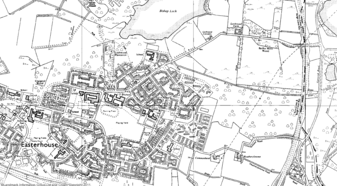
The Easterhouse estate sits on high ground 6 miles east of Glasgow city centre, bounded by two motorways, a loch and open countryside. Plans for a substantial estate to rehouse the residents of Glasgow’s inner-city tenements were held up by the war, but building work finally got underway in the early 1950s and by the time of the 1971 census, the former farmland of Easterhouse was home to over 56,000 people. Although some high rise dwellings were built, the majority of the estate consisted of houses and flats up to 5 stories, mirroring the low-rise principles of the garden city movement. But as with other estates built on garden city ideas, the spatial benefits of a peripheral location were outweighed by separation from the jobs and amenities of the city, compounded by poor public transport links and low levels of car ownership. By 2001 only 26,000 people remained at Easterhouse, and despite extensive regeneration the effects of population decline are clear today: half-demolished rows of houses; streets that wander aimlessly into fields; empty spaces where schools once stood. All this stands in contrast to the situation just the other side of Bishop Loch, less than a mile away, where the former Gartloch Hospital is being converted into a luxury village.
Maps © Crown Copyright and Landmark Information Group Limited (2012). All rights reserved. Made available by the superb Digimap service, run by EDINA at the University of Edinburgh.
